CCTV Drain Survey Norwood
Covering postcodes: SE27
Need a drain survey in Norwood?
London drainage specialists with same-day availability. WRC-standard report within 24 hours.
· Norwood, London
CCTV Drain Surveys in West Norwood
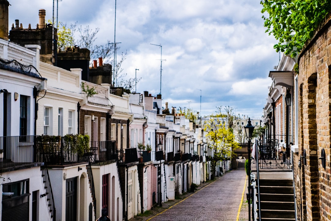
West Norwood is a diverse south London neighbourhood in the SE27 postcode, sitting within the London Borough of Lambeth and bordered by Tulse Hill to the north, Streatham to the east, and Crystal Palace and Gipsy Hill to the south. The area’s residential character is defined by its Victorian and Edwardian housing stock, and its drainage is defined by the age of that stock — clay pipe infrastructure that is now well over a century old.
CCTV drain surveys in Norwood use high-definition cameras to inspect drain runs from property connections to the public sewer boundary, providing WRC-graded condition reports. Request a free quote online.
West Norwood’s Housing and Drainage History
West Norwood developed as a south London suburb primarily during the late Victorian period, with the residential streets around West Norwood station and along the Knight’s Hill corridor built out from the 1880s through to 1910. This construction period used salt-glazed clay pipe as the standard drainage material — the same material used throughout Victorian London, and now 115-plus years old beneath SE27’s streets.
The Edwardian period added further development, including the larger properties in the Tulse Hill area and the Edwardian mansion blocks that line some of SE27’s broader streets. Post-war development and 1930s infill rounded out the borough’s housing stock. The drainage across this mixed stock ranges from Victorian clay pipe in the oldest terraces through to early concrete ware and pitch-fibre in the post-war sections.
London Clay and Root Ingress in SE27
West Norwood sits on London clay — the geological constant that underlies most of south London and creates the same ground movement patterns found throughout the clay band. London clay’s seasonal shrink-swell behaviour has progressively displaced clay pipe joints beneath SE27 over the past century, and those displaced joints have been exploited by root systems from the mature trees lining Norwood’s residential streets.
The trees in West Norwood and Tulse Hill include large plane trees along major residential roads, mature horse chestnuts in garden squares, and the varied garden planting of the area’s large converted Victorian houses. Root ingress in SE27 surveys is a consistent finding — present in the majority of Victorian clay drain runs we inspect.
Shared Drainage in Converted Properties
A significant proportion of West Norwood’s larger Victorian and Edwardian houses have been converted to flats. This conversion history — which has accelerated over the past 30 years as house prices have made individual purchase of large Victorian properties increasingly difficult — creates shared drainage complexity throughout SE27.
When a Victorian house is converted to three flats, the shared drain run from the building to the public sewer connection becomes a joint responsibility of all leaseholders and the freeholder. In practice, this shared drain often receives inconsistent maintenance, and defects can develop over years without any single party taking responsibility for investigation or repair.
Pre-purchase surveys of converted property in SE27 serve a dual purpose: they establish the current condition of the shared drainage and provide buyers with a clear understanding of the maintenance liability they are taking on alongside the property. Freeholders unable or unwilling to provide drainage maintenance records should prompt buyers to commission an independent survey before exchange.
The Knight’s Hill Gradient
The western part of SE27 rises steeply from Norwood Road towards Knight’s Hill — a gradient that affects drainage performance in properties on these slopes in the same way it does throughout the elevated parts of south London. Drain runs beneath steeply sloping back gardens develop gradient-related characteristics: higher flow velocities, progressive invert erosion in older clay pipes, and silt accumulation at gradient transition points.
Properties at the top of Knight’s Hill and in Crown Dale have the most pronounced gradient effect on their drainage. CCTV surveys of these properties establish the gradient profile of each drain run and identify any erosion, silt accumulation, or backfall sections created by hillside ground movement.
What CCTV Surveys Reveal in West Norwood
Across SE27, the most consistent survey findings are:
Multiple displaced joints in Victorian clay drain runs — typically 3–6 joint displacements per drain run in properties built before 1910.
Root ingress at displaced joints throughout the clay pipe network — ranging from fine root tendrils through to substantial root masses.
Shared drainage defects in converted buildings — accumulated silt, structural defects in shared inspection chambers, and in some cases collapsed sections in shared drain runs.
Gradient-related silt accumulation in properties on Knight’s Hill and Crown Dale slopes.
Fat and grease deposits in terrace properties near West Norwood High Street and the surrounding commercial areas.
Request a free quote online for CCTV drain surveys in West Norwood SE27.
Property Types in Norwood
- Victorian terraces
- Edwardian semis and terraces
- 1930s semis
- Converted Victorian houses
- Purpose-built Edwardian mansion flats
- Modern flats
Common Drainage Issues in Norwood
- Root ingress in Victorian clay pipe drainage
- Joint displacement from London clay movement
- Shared drainage complexity in converted properties
- Fat and grease accumulation near high street commercial uses
- Pitch-fibre deformation in later post-war stock
- Collapsed brick inspection chambers
- Drainage gradient variation across sloping streets
Frequently Asked Questions — Norwood
What makes West Norwood's Victorian terraces a particular drainage risk?
How does Norwood's connection to Lambeth affect drainage responsibility?
Are the converted Victorian houses in Tulse Hill worth surveying before purchase?
Does the gradient of Norwood's streets affect drainage performance?
Get a free survey quote today
Local engineers covering Norwood. WRC-standard reports, no hidden fees.